Date: Sunday, 02 June 2024


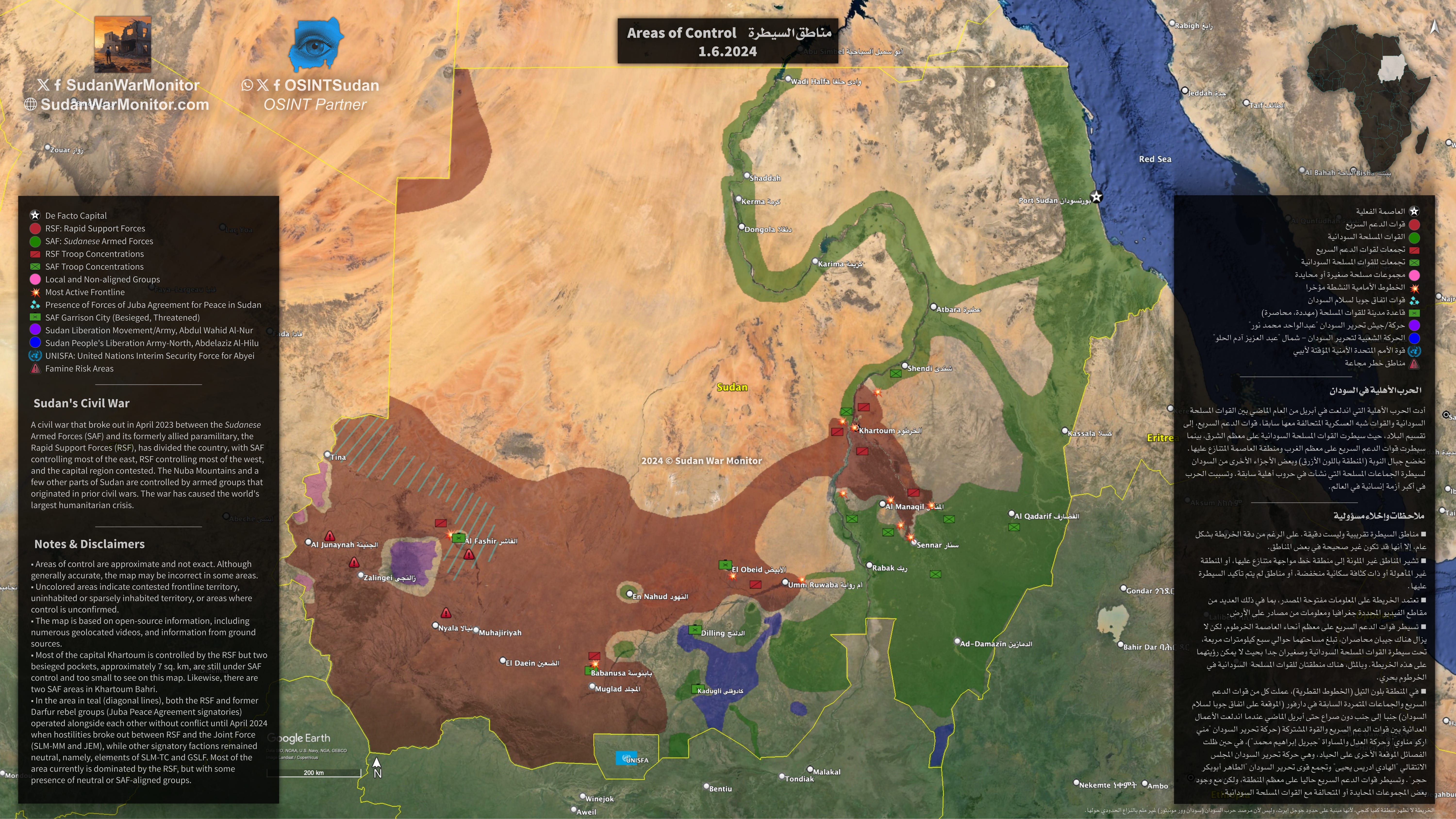
The map also indicates the territories controlled by armed groups that originated in prior civil wars, including the SPLM-North in the Nuba Mountains of South Kordofan, and the Sudan Liberation Movement/Army in the Jebel Marra Massif of Central Darfur.
Mapping the conflict in Sudan is difficult because of the vastness of the country, a shortage of reliable reporting, deliberate disinformation, communications blackouts, and the fluid nature of the situation in certain areas. Nevertheless, we were able to produce this map by geolocating videos filmed by combatants, as well as traditional journalism techniques, including information provided by local sources.
Sudan War Monitor is a journalism project that began last year as a voluntary initiative in response to the outbreak of war in Sudan, in collaboration with a collective of open source researchers (OSINT Sudan). Our original aim was to fill gaps in the public’s understanding of the ground-level military situation. Additionally, we try to cover humanitarian efforts, peace initiatives, and key political developments.
We are a reader-supported independent publication, not affiliated with any warring party. If you liked this map, please sign up for a monthly subscription, make a one-time donation via Stripe, or share to support our work, so that we can continue producing more reports, maps, and analysis.